Gautham Manoharan
Travel time prediction using a Machine Learning Model
Programmed a Supervised Machine Learning Algorithm for travel time prediction from Real-Time GPS data of cars running in Electronic City, Bangalore.
Problem
My work with VISSIM involved optimization to match the simulation conditions to real-world condition. One measure that is used to verify simulation accuracy is the travel-time on links within the network. It is thus necessary to infer the travel time on the links in the network. To do so, we had access to 29 vehicles' GPS data in real-time.
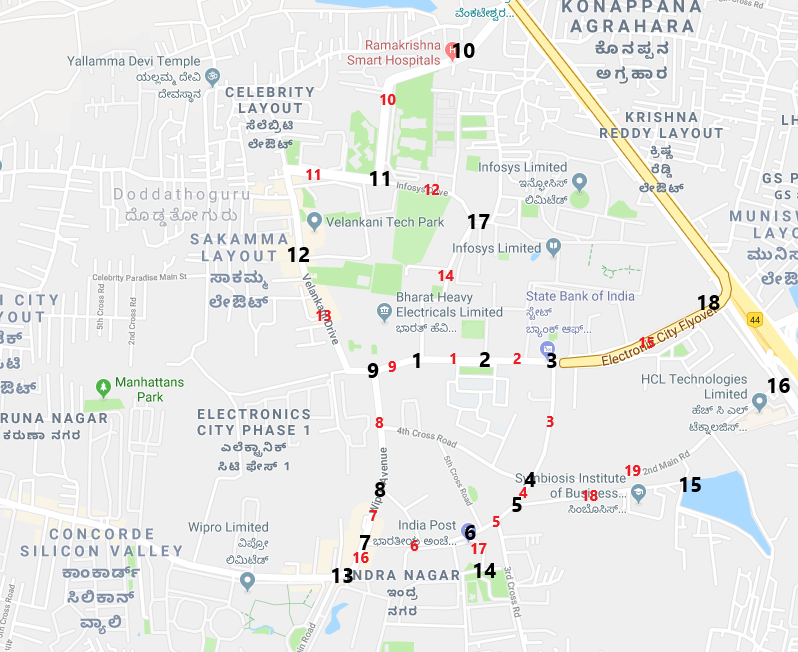
Road Network with Links and Nodes marked:
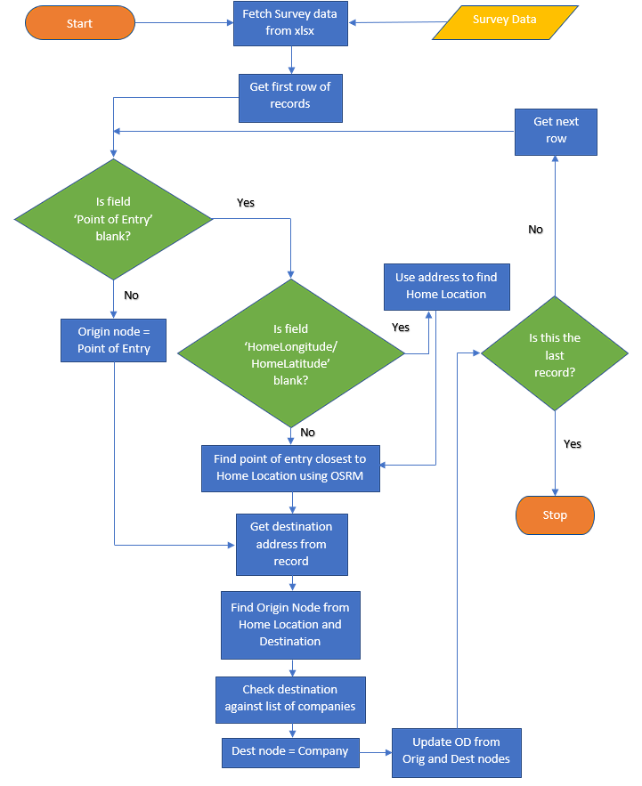
Work
The GPS data from 29 vehicles in Electronic City was extracted and I wrote a map-matching algorithm to map-match the extracted data to Electronic City Open Street Map (OSM) network. This was programmed in Python using the OSMnx library. This is how for each trip, the links traversed and the travel-time is found.
Based on the information of each link, which is extracted from OSM network which is an open-source alternative to Google Maps, a machine learning model was built to determine the travel time for trips within Electronic City. The link speed for different categories of links within the network was estimated and was used to predict travel times for future trips for different time intervals.
Link Categories in the network:
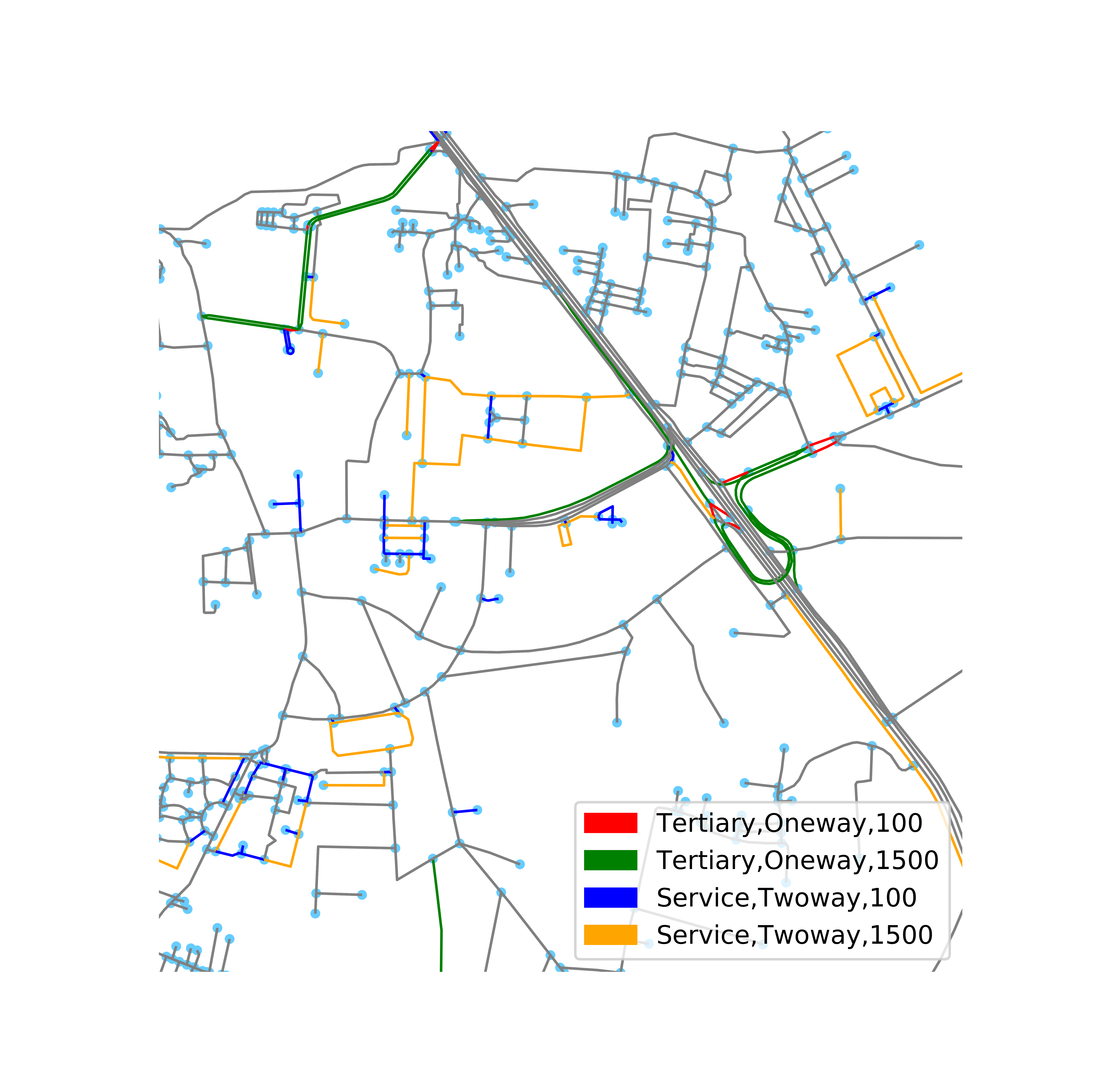
Time of travel and link category plays a crucial role in determining the travel time along with the link length, so these were accounted for when building the ML model. After careful outlier rejection to account for stops not due to traffic, achieved a final model with an R2 score of 0.88.
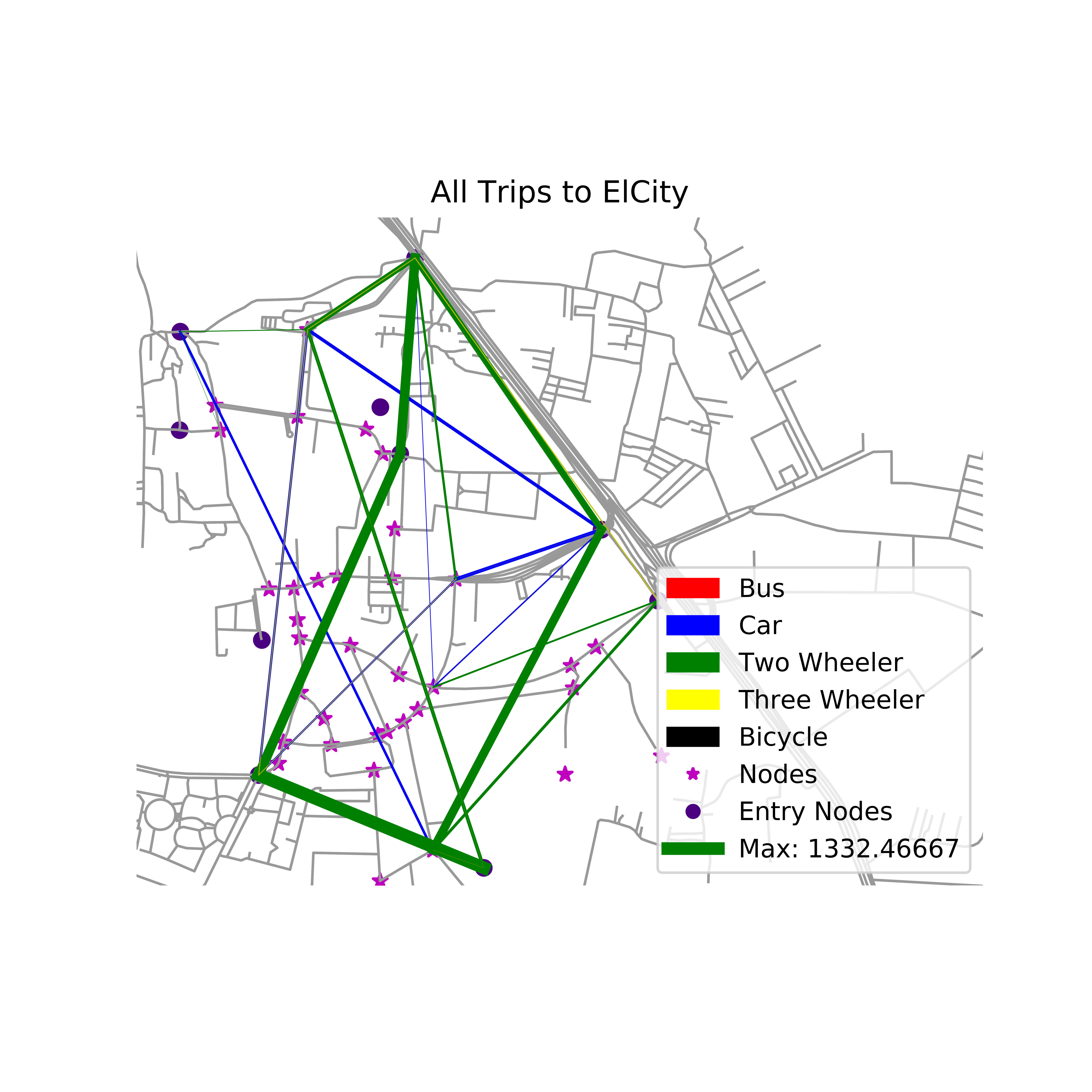
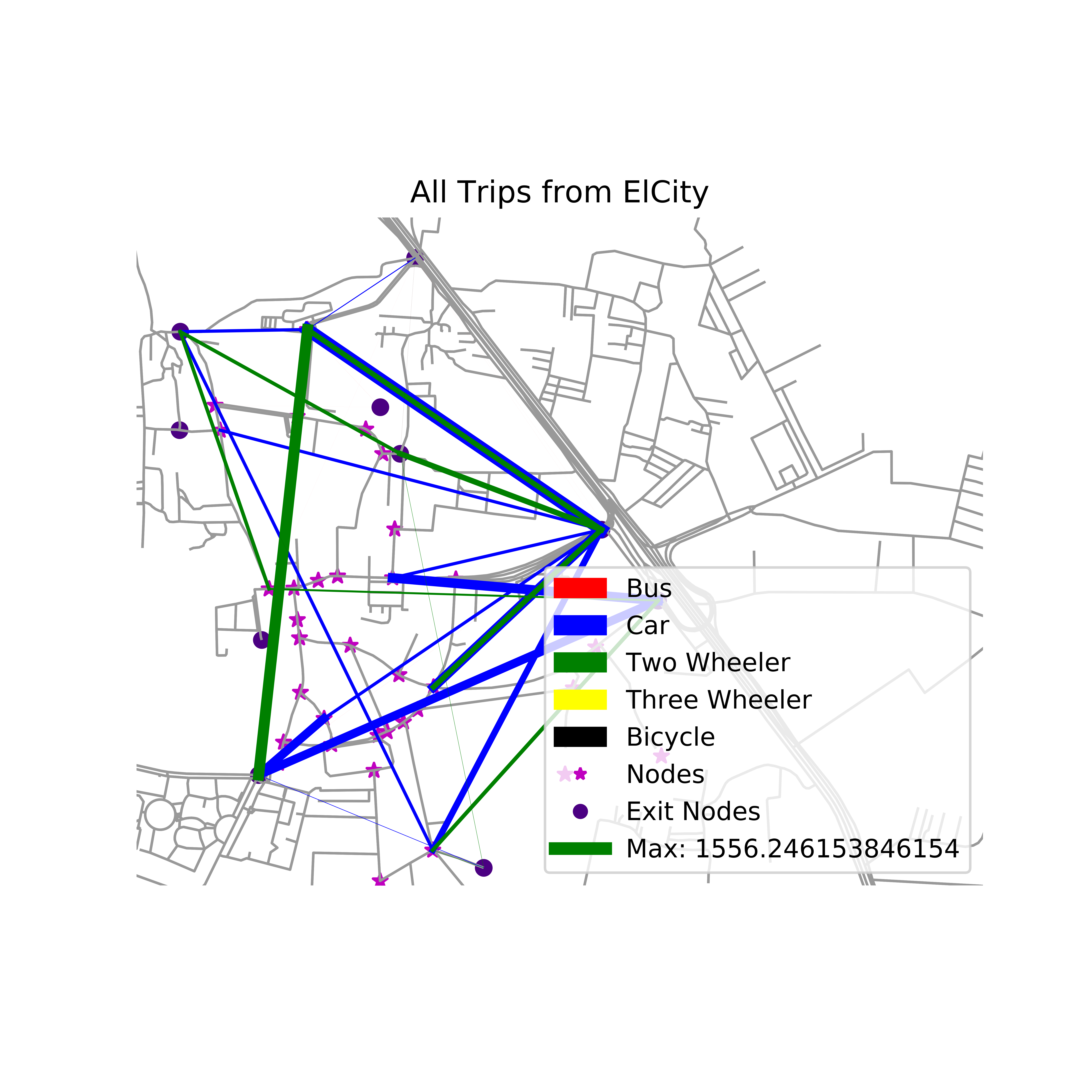
Transit Ridership Analysis and Setting up Exogenous Variables
Additionally, worked on database management and data acquisition with the Bengaluru Metro Transport Corporation to setup Exogenous Variables to produce Transit Ridership Prediction Models to improve the public bus system of Bengaluru City. Work invloved analysis of survey data from around 1500 employees in Electronic City to analyze and find optimum bus routes and timings.
Images: